Forests are among our most powerful allies in tackling the climate crisis. They store carbon, protect biodiversity, protect our groundwater and offer space for recreation. Yet, managing them wisely requires more than boots on the ground – it calls for pixels, algorithms, and collaboration across disciplines.
This is where INNO4EST comes in. As one of the research projects in the INNO-CCUS portfolio, the initiative brings together foresters, ecologists, researchers, and data scientists to create new ways of seeing and understanding forest ecosystems. By combining satellite images, drone data and machine-learning models with field data, field studies and ecological expertise, they are developing tools that can map not just where trees grow, but how forests sustain themselves, interact with surroundings, and deliver benefits.
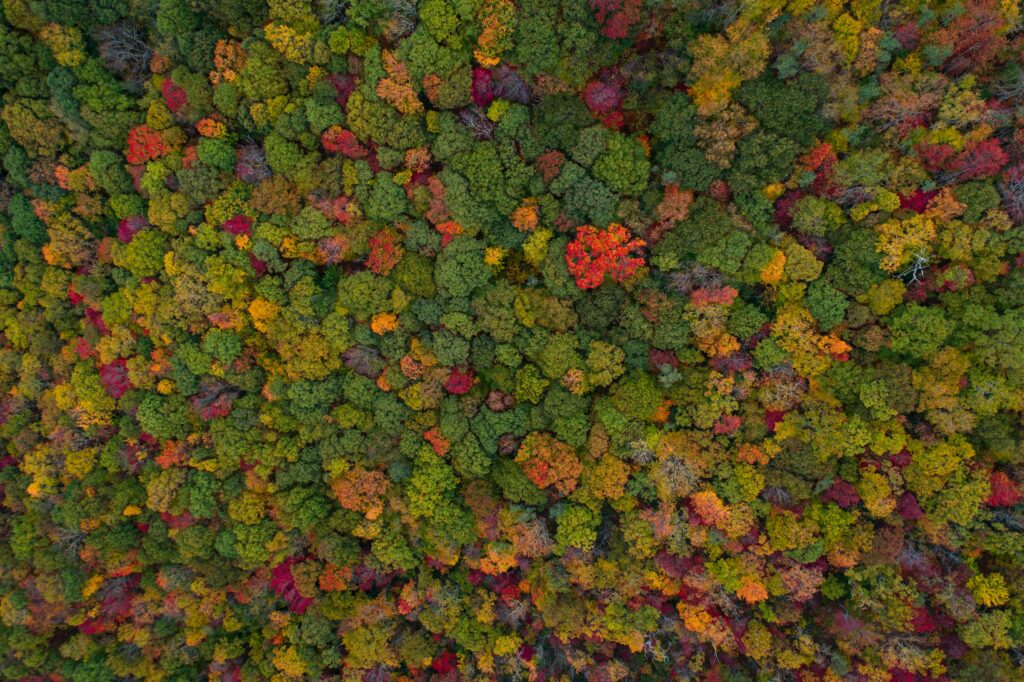
From pixels to patterns
A forest can look healthy to the human eye while still losing its ecological balance. Remote sensing technologies now allow researchers to detect these shifts more efficiently and across large areas that would otherwise require extensive fieldwork to observe – shifts in canopy height, biomass density or species composition that reveal how a forest is changing over time.
Through machine learning, thousands of satellite and drone images are transformed into detailed maps that show how forests breathe, grow and store carbon. Historical aerial photos from as far back as the 1950s can even be compared with today’s high-resolution data, providing a time machine for understanding decades of land-use change.
These methods are not ends in themselves. They help foresters and land managers find new ways to plan, evaluate and prioritize where afforestation and nature protection will deliver the greatest environmental and social value.
At the heart of INNO4EST is collaboration. Bringing together disciplines that rarely share the same toolbox is both the challenge and the strength of the project.
Ecologists bring knowledge of species and habitats. Geographers contribute spatial understanding of landscapes. Data scientists develop algorithms that turn complex datasets into usable insights. And foresters connect it all to practice – to the trees, the soil and the people who manage them.
By working together, they are defining a new common language for ecosystem services assessment. It is a shift from isolated research projects to integrated systems that link data with real-world management and policy decisions.
As a research partnership, INNO4EST includes many smaller projects testing their own methods and solutions – each contributing a piece of knowledge to find the best way forward together. The process thrives on curiosity and dialogue, where open questions and fresh ideas from peers and practitioners help push innovation further.
New standards for sustainable forest management
The results are already visible. Mapping deadwood, biomass and structural diversity creates new indicators for biodiversity and carbon storage. Recreation potential can now be quantified, helping planners design forest areas that serve both nature and people – supporting Denmark’s path towards its 2050 climate goals.
These data-driven insights are essential for balancing multiple goals: climate mitigation, adaptation, biodiversity protection, and human well-being. They also make forest data transparent and comparable, a foundation for future policy and investment decisions in Denmark’s nature-based solutions.
INNO4EST’s interdisciplinary model could become a blueprint for how we approach natural climate solutions more broadly. It reminds us that technology alone cannot solve environmental problems – but when guided by ecological understanding, ground truth data, and used collaboratively, it can help us make better choices for the landscapes we depend on.